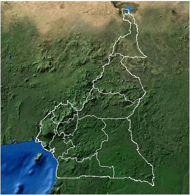
The central and western parts of Cameroon are dominated by high mountains and Plateaus respectively. The high western range has peaks which vary in elevation; 4100 m (mount Cameroon), 2250 (Mt. Manengouba), 2070m (Mt. Kupe), 2740 m (Mt Bamboutos), 2263 m Mt. Nkogam, 2119 m Mt. Oku and Mbot and the Mandara with certain peaks higher than 2000m. The Adamawa or Central High plateau has an altitude of between 1000 to 1500m. Both the western range and the Central high plateau are affected by volcanic and tectonic activities giving rise to faults, volcanic cones and volcanic lakes. These two sectors constitute the main watersheds of Cameroon’s drainage systems through the Sanage, the Benue, the Wouri, Moungo-Cross or Manyu and Donga-Mantung, towards the Atlantic Ocean.
The southern section of the country is dominated by a plateau (500 to 900m) which gently slopes to the east (Congo basin) but falls by steps to the Atlantic coast. Volcanic and tectonic activity affected this area too. While the far North is dominated by the lake Chad Basin, its southern fringe is strongly characterized by the River Benue Basin both of which present a monotonous relief. The narrow coastal zone is marked by unstable mangrove swamps, especially from the Wouri-Moung Basins to the Ndian-Akpa-Yafe Basins. The southern coastline and the ambas Bay region are rocky, cliffy and strewn with relic rocky islets, dating from the early volcanic period.
See link to map of relief…..

Visit these links for information on the climate and drainage

